
San Diego County · 92036 · California
Julian Homes for Sale
About Julian
Julian is an unincorporated mountain community in eastern San Diego County, and this page is a child of the Ramona hub. Two official geographies share the name, and they are not the same shape. The Census Bureau’s Julian census-designated place covers 7.886 square miles, all land. The 2020 census counted 1,768 people there, up from 1,502 in 2010, and 988 housing units, of which 24.0 percent were vacant. The census counted 751 households and classified 100 percent of the CDP population as living in a rural area. The ZIP code published for the CDP is 92036. A 92036 mailing address can sit outside that census place. The county’s Julian Community Plan Area is the larger geography the 2011 plan regulates. Citing 2010 SANDAG estimates, the plan identifies a population of 3,018 and 1,710 housing units inside the planning area. A listing that says only “Julian” can fall in the census place, in the wider plan area, or on a ZIP route that is neither. The street and the tax bill matter as much as the name.
The Board of Supervisors adopted the community plan on August 3, 2011. An earlier plan had been adopted on December 16, 1976. The 2011 text places the plan area between Volcan Mountain and the Cuyamaca Mountains. State Highway 78/79 is Main Street and the plan’s main route from metropolitan San Diego, which the plan places 60 miles to the west. The same circulation findings describe two primary approaches: Highway 78/79 from the west, where 78 from the west and 79 from the north merge in Santa Ysabel, and Highway 79 from Interstate 8 via Cuyamaca from the south. The plan says people from Santa Ysabel, Cuyamaca, Warner Springs, Mesa Grande, Banner, and Shelter Valley use Julian’s community facilities. It says Julian relies on larger neighboring communities for major services, and its mobility policies name Ramona, Escondido, San Diego, and Borrego Springs as the major population centers to keep public transportation with. Ramona is the existing hub on the Highway 78 side of that list, which is why this page sits under Ramona rather than as a second Ramona page. The plan does not put Julian inside the Ramona plan area. Commercial use is located primarily in two places the plan names: Wynola, and the Historic District. The plan states that the Julian Rural Village is a County Historic District and was registered as California Historical Landmark No. 412 on November 15, 1942, and that it was not listed on the National Register when the plan was written.
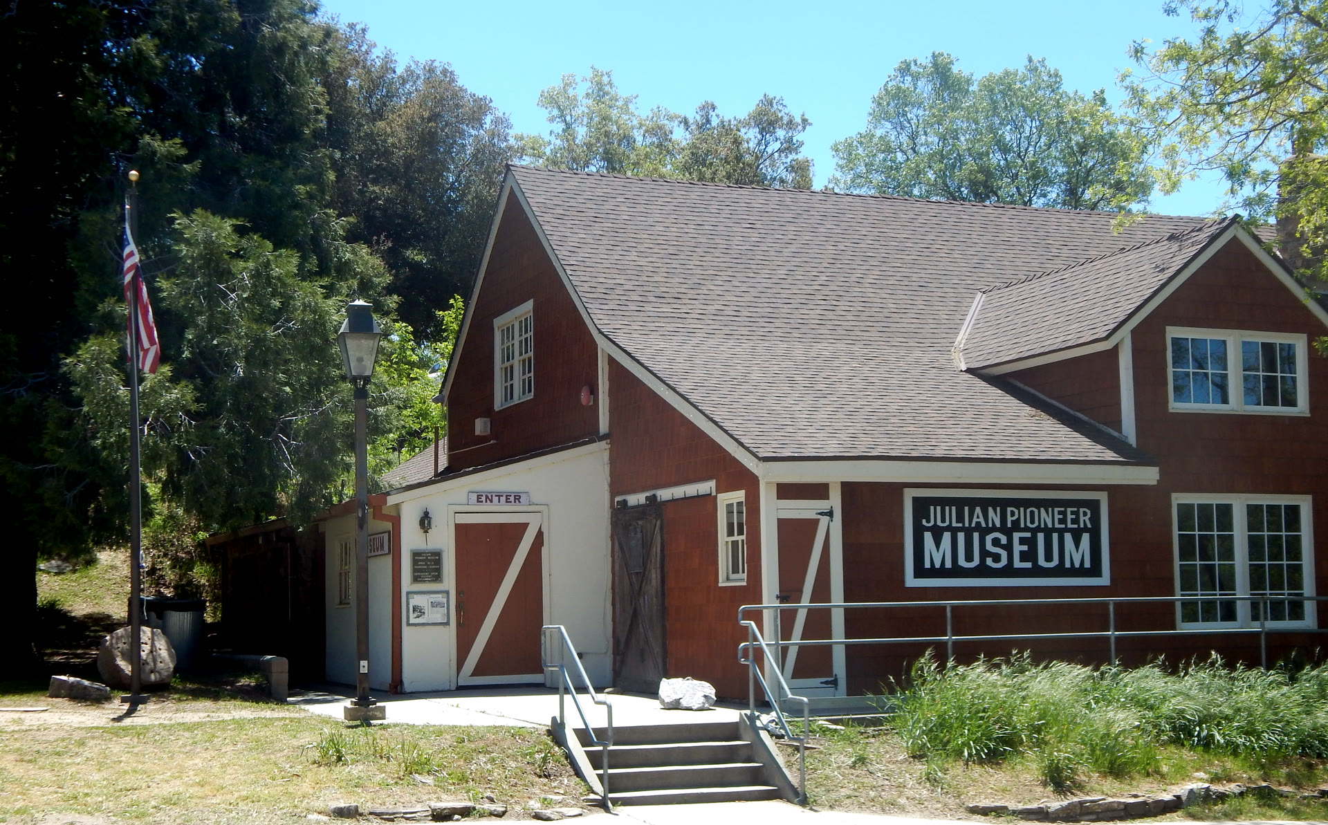
The plan describes residential land as identifiable subdivisions with scattered houses between them, and it says a large share of potential building sites are not full-time residences. Its 2010 SANDAG citation says about 27 percent of the 1,710 planning-area housing units were not permanently occupied and were used as second homes, and that over 97 percent were single-family. Those are plan findings, not a current occupancy census and not a description of a particular parcel. Agricultural zoning covers most of the plan area. The plan says a large portion is in agricultural preserves, with cattle grazing as the major use, and it also names horse breeding, tree crops, and wine making. The introduction identifies apples and apple products as part of the town’s commercial base. The town site has a limited public sewer. The rest of the community uses on-site septic systems. The town site and several outlying areas are on water districts supplied by wells. Other residents use private wells. The plan’s water findings say groundwater is the sole domestic supply, that it is limited by granitic rock, and that the average level lot size generally considered safe on that groundwater estimate is five acres. That sentence is a generalization in the plan. It is not a zoning minimum for every parcel and not a well test. This page does not publish a median price. Use the live listings, then read the tax bill, any CC&Rs, and the well and septic records. The photograph is the Julian Pioneer Museum at 2811 Washington Street in May 2021. It is not a listing. The map is an orientation box around that museum, not the plan boundary and not the 7.886-square-mile census place.
At a Glance
Living in Julian
A Census Place and a Larger Plan Area
The 2020 census CDP is 7.886 square miles, with 1,768 people and 988 housing units. The 2011 plan, citing 2010 SANDAG, identifies 3,018 people and 1,710 housing units in the planning area. Do not treat those as one current count.
Ramona on the Highway 78 Side
The plan’s western approach is Highway 78/79 through Santa Ysabel. Its mobility policies name Ramona among the major population centers the Julian area connects to. Ramona is the parent hub. A Julian address is not a Ramona address.
Wynola and the Historic District
The plan places commercial use primarily in Wynola and the Historic District. It records the Julian Rural Village as a County Historic District and as California Historical Landmark No. 412, registered November 15, 1942.
Subdivisions, Acreage, and Second Homes
The plan describes subdivisions mixed with scattered houses on large acreage. Its SANDAG citation says about 27 percent of planning-area units were second homes, and over 97 percent were single-family. Those findings do not describe one parcel.
Wells, Septic, and a Five-Acre Generalization
Public sewer is limited to the town site. Water is groundwater, from district wells or private wells. The plan says a level lot of about five acres is the size its groundwater estimate generally treats as safe. A parcel still needs its own well and septic review.
Schools by Address, Not by the Town Name
NCES lists Julian Elementary, Julian Junior High, and Julian High in the two Julian Union districts. The 2011 plan also names Spencer Valley as a third district, plus charter and continuation programs. Confirm the house.
Schools Serving Julian
NCES lists two districts. Julian Union Elementary, at 1704 Cape Horn Avenue, Julian, CA 92036, (760) 765-0661, includes Julian Elementary (kindergarten–5, 189 students in 2024–2025) and Julian Junior High (grades 6–8, 110 students). Both school directory records use the mailing address PO Box 337, Julian, CA 92036. Julian Union High is a separate district: Julian High (grades 9–12, 112 students in 2024–2025) is at 1656 Highway 78, Julian, CA 92036, (760) 765-0606. The adopted 2011 community plan says the community is served by three districts — Julian Elementary, Julian High School, and Spencer Valley — and it names Eagle Peak Charter School and Ray Redding Continuation School as supplements. That paragraph is the plan’s map, not a promise that every 92036 address is in Julian Union, and it is not a statement that those charter or continuation programs are open today. Assignments are address-specific. Confirm the property with the district before you rely on a campus.
| School Name | Grades | District |
|---|---|---|
| Julian Elementary | KG–5 | Julian Union Elementary · PO Box 337, Julian · 189 students (2024–2025) |
| Julian Junior High | 6–8 | Julian Union Elementary · PO Box 337, Julian · 110 students |
| Julian High | 9–12 | Julian Union High · 1656 Highway 78, Julian · 112 students |
School assignments are address-specific and subject to change. Verify enrollment zoning directly with Julian Union Elementary and Julian Union High before purchasing. This data is for informational purposes only.
Julian on the Map
The Julian
Lifestyle
The community plan separates the town site from the rest of the plan area. In town, State Route 78/79 is Main Street, the public sewer is limited to that town site, and the Historic District is the commercial core the plan pairs with Wynola. Outside that core, the plan describes subdivisions and scattered houses, agricultural preserves used mainly for cattle grazing, and private wells and septic systems. A house on a town lot and a house on a larger parcel along Highway 78 or 79 are both “Julian.” They are not the same lot size, the same water system, or the same set of rules.
The plan’s 2010 housing citation says about 27 percent of planning-area units were second homes. That is a description of occupancy in that estimate. It does not say what a current listing is used for, and it does not say who should buy it. Association dues, if a tract has an association, and any special tax are parcel facts. The community plan does not publish one dues number or one Mello-Roos levy. Read the CC&Rs if the parcel has them, the county tax bill either way, and the well and septic documents before you treat two Julian addresses as the same kind of house. The plan also notes severe fire hazard from drought and Santa Ana winds, and proximity to the Elsinore fault. Those are plan findings to ask about on a specific parcel, not a community-wide score.
- Unincorporated community; this page is a child of the Ramona hub
- Census CDP and the county plan area are different boundaries and different counts
- Commercial core in the Historic District and at Wynola, on Highways 78 and 79
- Town-site sewer is limited; other parcels are on septic, and water is groundwater
- Plan findings name grazing, tree crops, and about 27 percent second homes in 2010
- Julian Union for the current directory; the 2011 plan also names Spencer Valley
Mello-Roos
The Julian Community Plan does not publish a single Mello-Roos amount for the community. A special tax, where one exists, is a parcel levy used to repay bonds for public infrastructure. It is collected with the property tax. It is not an association assessment, and it does not follow from ZIP code 92036.
Mello-Roos districts are drawn around the projects they finance. A house in one subdivision and a house on an older rural parcel can carry different levies, or none. The end date, if there is a levy, is on that parcel’s tax bill.
Association dues are a separate charge. A parcel may have no association at all. The plan’s mention of agricultural preserves, water districts, and private wells is a description of how the plan area is served. It is not a statement that every lot pays district fees or club dues. A water-district charge, a well, and a septic system are separate from both the tax bill’s special taxes and any CC&Rs. Compare two addresses only after you have both tax bills and, where they exist, the association documents and the well and septic records.
Quick Facts
Mello-Roos and other special taxes vary by parcel and district. Confirm the current levy with the county tax collector or the Community Facilities District before you rely on it, and ask a tax adviser if you need advice about deductibility.
Need Help Understanding Mello-Roos?
Palisade Realty can walk through the parcel tax bill, the well and septic records, and any association documents for a specific Julian address before you write an offer.
Julian Homes For Sale
Julian FAQ
Where is Julian, and what ZIP code is it?
Julian is an unincorporated community in the mountains of eastern San Diego County, between Volcan Mountain and the Cuyamaca Mountains. The census-designated place uses ZIP code 92036 and covers 7.886 square miles. The county community plan area is larger. State Routes 78 and 79 run through town. The western approach the plan describes is Highway 78/79 through Santa Ysabel, toward Ramona. The ZIP alone does not place a house inside the census boundary.
Is Julian part of Ramona?
No. Julian has its own community plan, adopted August 3, 2011, and it is not inside the Ramona plan area. This page is a child of the Ramona hub because the Julian plan’s mobility policies name Ramona as one of the major population centers the area connects to, and Ramona is the existing hub on Highway 78 west of Santa Ysabel. A Julian address is not a Ramona address. Confirm the school district and the tax rate on the specific parcel.
How many homes are in Julian?
The 2020 census counted 988 housing units in the Julian census-designated place, 24.0 percent of them vacant, and 751 households. The county community plan, citing 2010 SANDAG estimates, identifies 1,710 housing units in the larger plan area, about 27 percent of them not permanently occupied. Those are different boundaries and different years. Neither figure is a count of homes for sale today. Use the live listings for current inventory.
Which schools serve Julian?
NCES lists Julian Elementary (kindergarten–5, 189 students) and Julian Junior High (grades 6–8, 110 students) in Julian Union Elementary, and Julian High (grades 9–12, 112 students) at 1656 Highway 78 in the separate Julian Union High district. Those membership figures are for 2024–2025. The 2011 community plan also names Spencer Valley as a third district serving the community, and it names Eagle Peak Charter and Ray Redding Continuation as supplements. Confirm the address with the district.
Do Julian homes have Mello-Roos, an HOA, or a public water hookup?
The community plan does not state one Mello-Roos levy or one set of association dues. Some tracts have an association, some have a special tax, and some have neither. Public sewer is limited to the town site, and domestic water is groundwater, either from a water district supplied by wells or from a private well. Read the county tax bill, the well and septic records, and, if the parcel has them, the CC&Rs. Do not infer any of those charges from ZIP code 92036.
Nearby Communities
to Consider
How Julian compares to neighboring areas — each with its own character, price point, and lifestyle.
| Community | Starting Price | Why Consider | |
|---|---|---|---|
| Ramona | See listings | The existing hub on Highway 78 west of Santa Ysabel, and the parent hub for this page. | → |
| Escondido | See listings | One of the major population centers the Julian plan’s mobility policies name, with its own hub. | → |
| Alpine | See listings | An existing East County hub on Interstate 8. The plan’s southern route is Highway 79 through Cuyamaca, not through Alpine. | → |
Find Your Home
in Julian
Explore available residences in Julian. Hedda Parashos and the Palisade Realty team work this part of San Diego, including Ramona.